


Chapter 5: Lifeline, A Water Storytelling Project
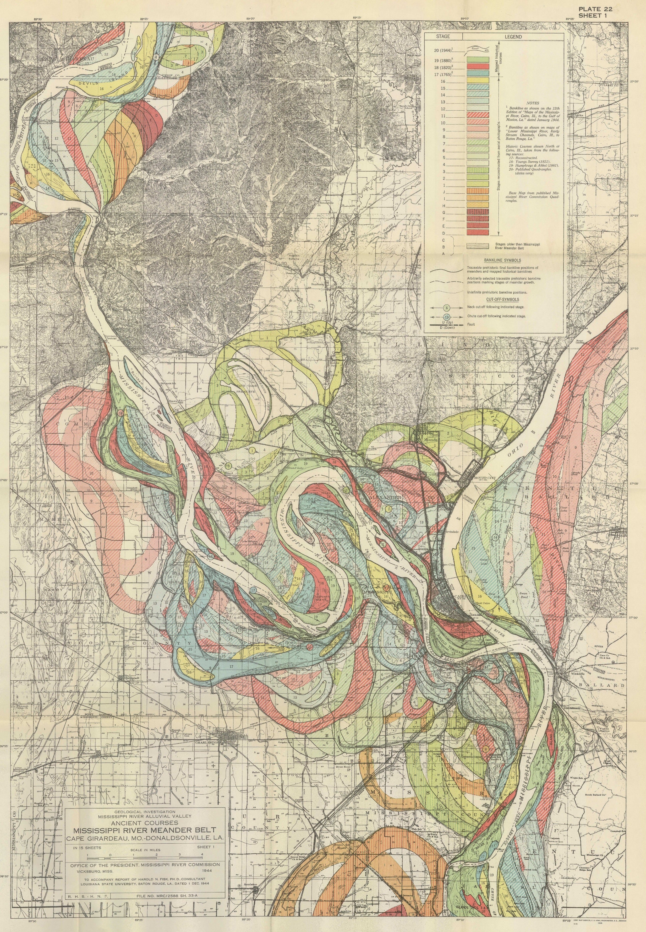
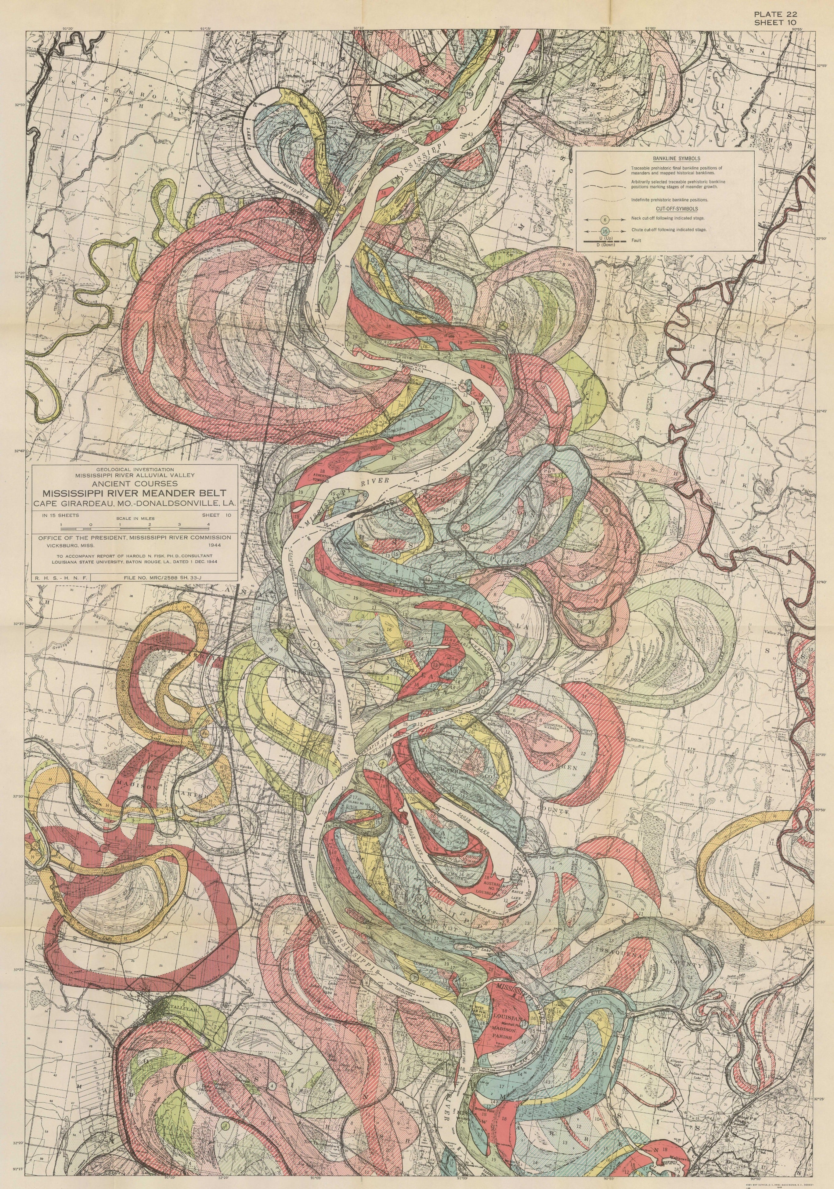
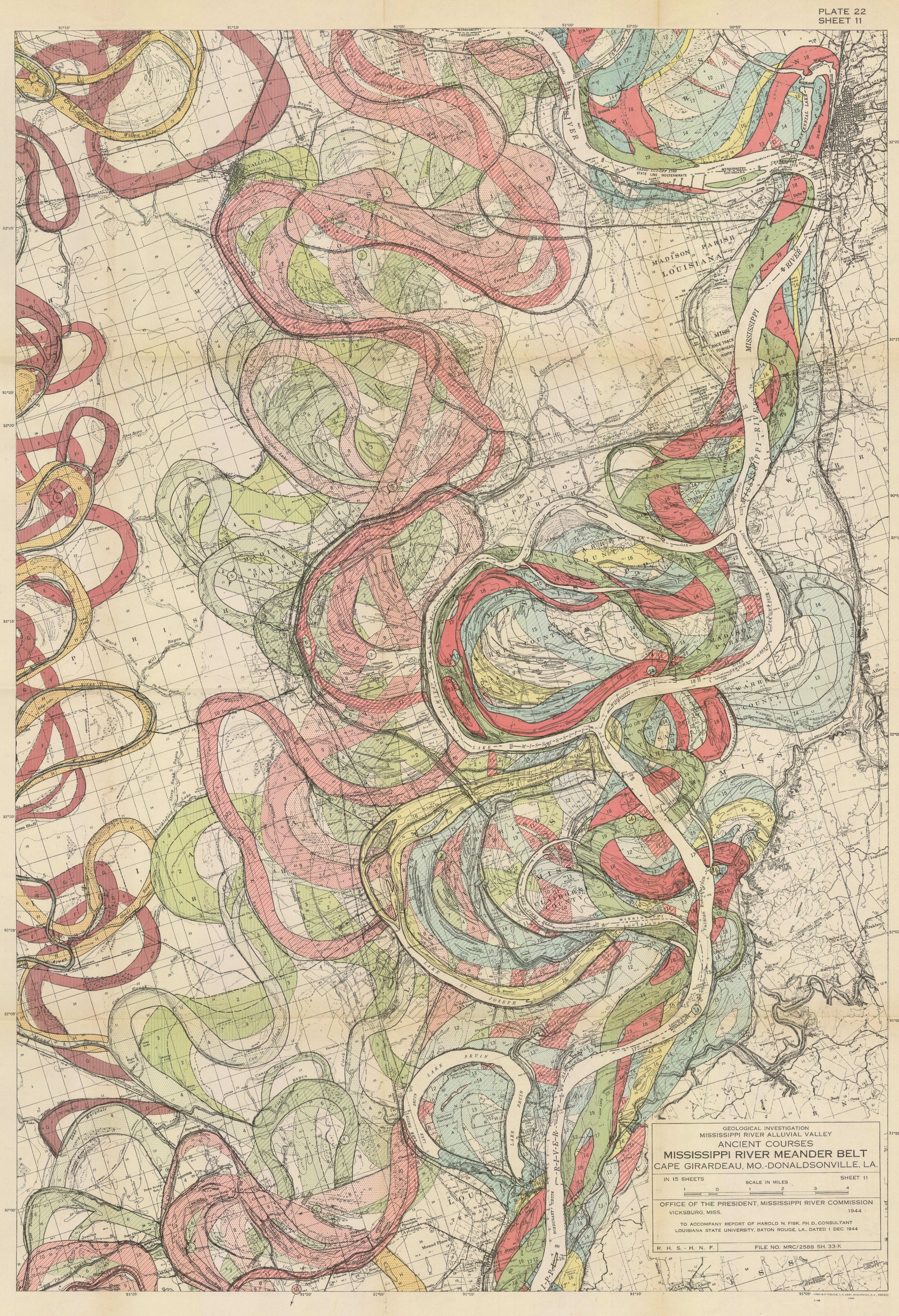
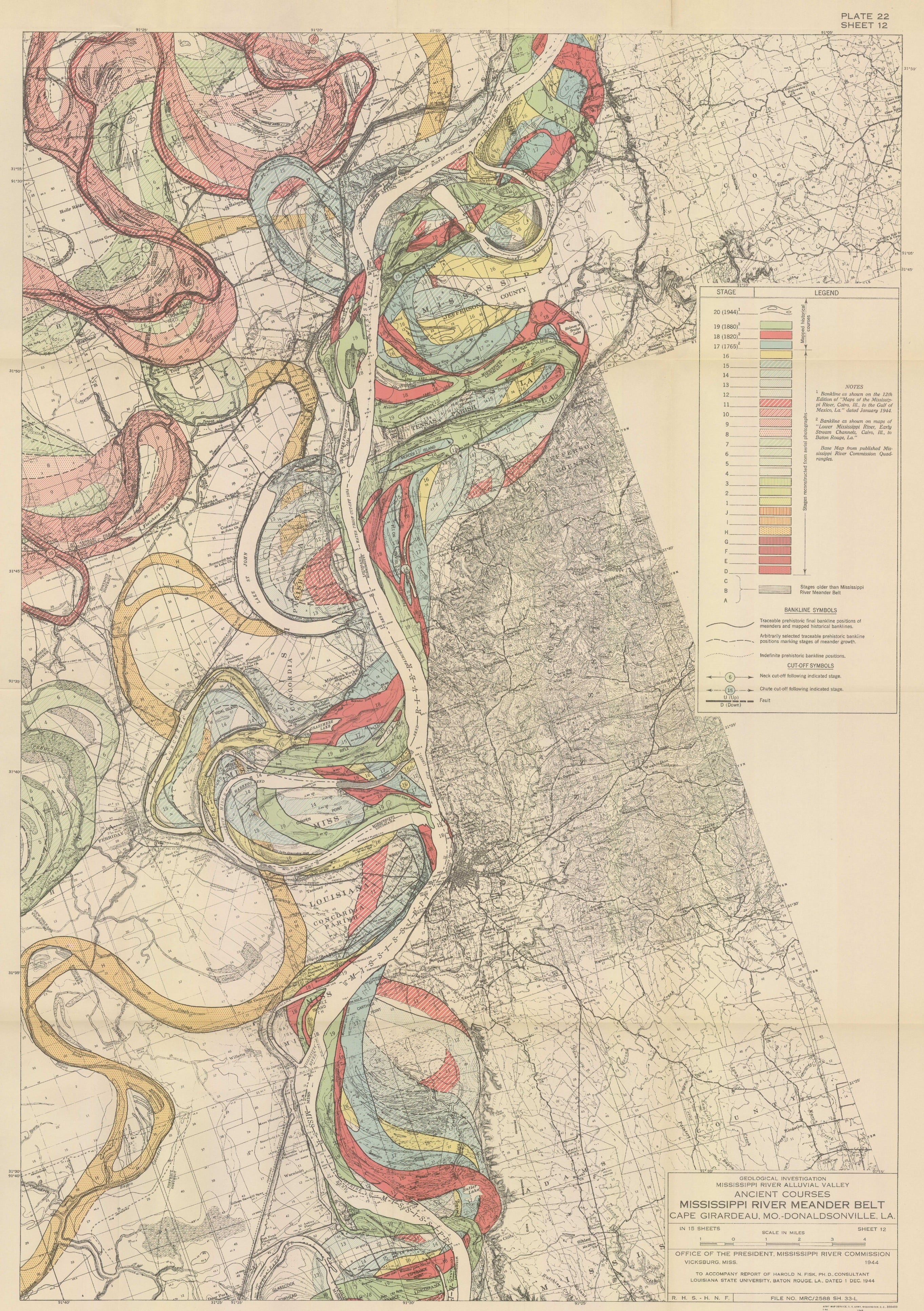
Fisk's Meander Maps of the Mississippi River (1944) and Clockwise at TOTAH

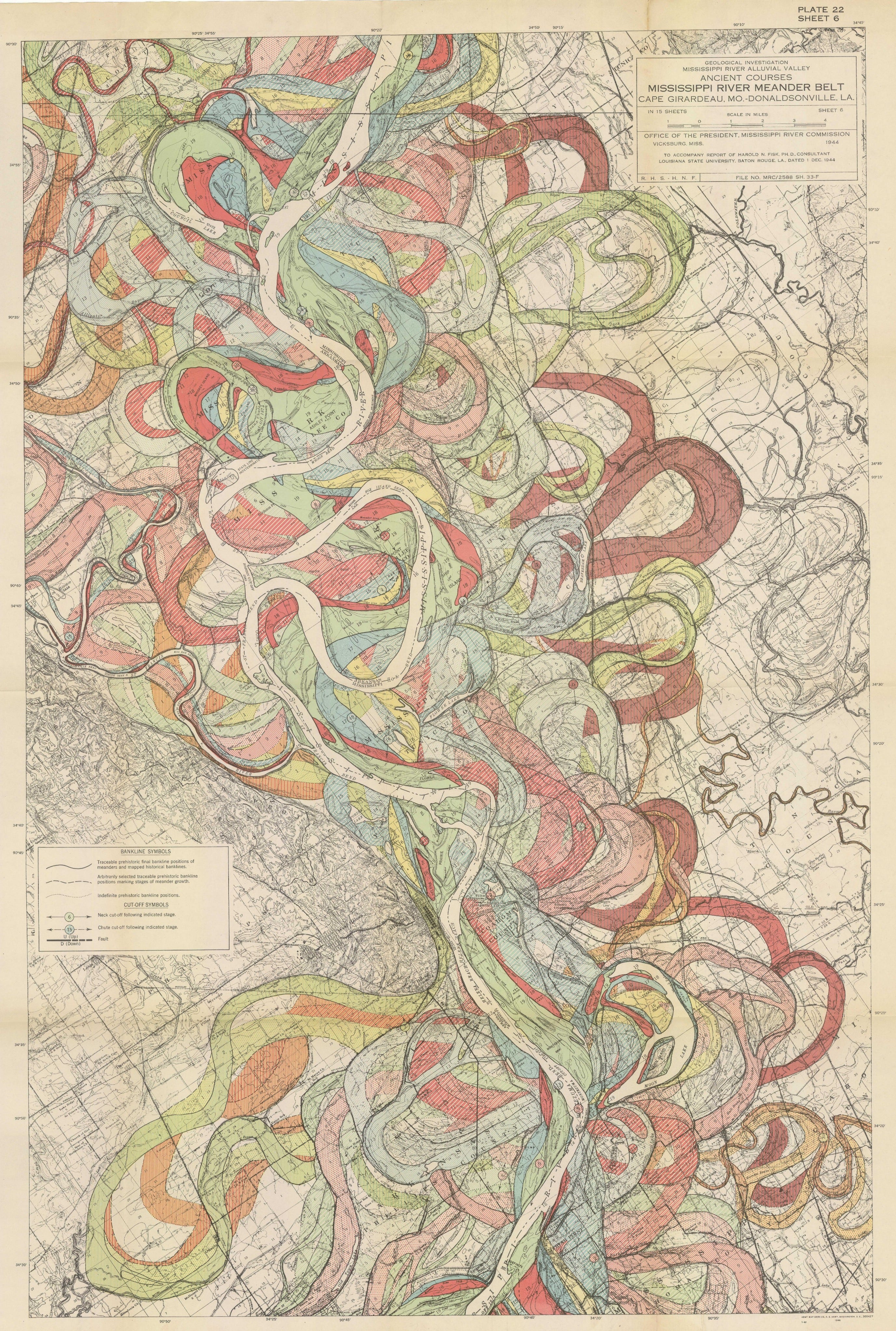
During a studio visit years ago, my friend Sam Anderson told me about these maps by Harold Fisk. At the time, we were collaborating on projects related to my public art intervention, Constellation.
I continue to be fascinated by the fact that they don’t just document the location of the Mississippi River at the time they were made, but consider the flow of time and how the river meanders across the earth. Each map records thousands of years of the river's evolution and life. Harold Fisk, a cartographer for the Army Corp of Engineers, recognized the Mississippi River as a living, changing body. In his 1944 report, "Geological Investigation of the Alluvial Valley of the Lower Mississippi River," Fisk investigated the Mississippi and its constant evolution with such gesture and vitality.
I am reminded of this quote by Toni Morrison–
“Floods' is the word they use, but in fact it is not flooding; it is remembering. Remembering where it used to be. All water has a perfect memory and is forever trying to get back to where it was."
Thank you for joining me here!
XO
MM
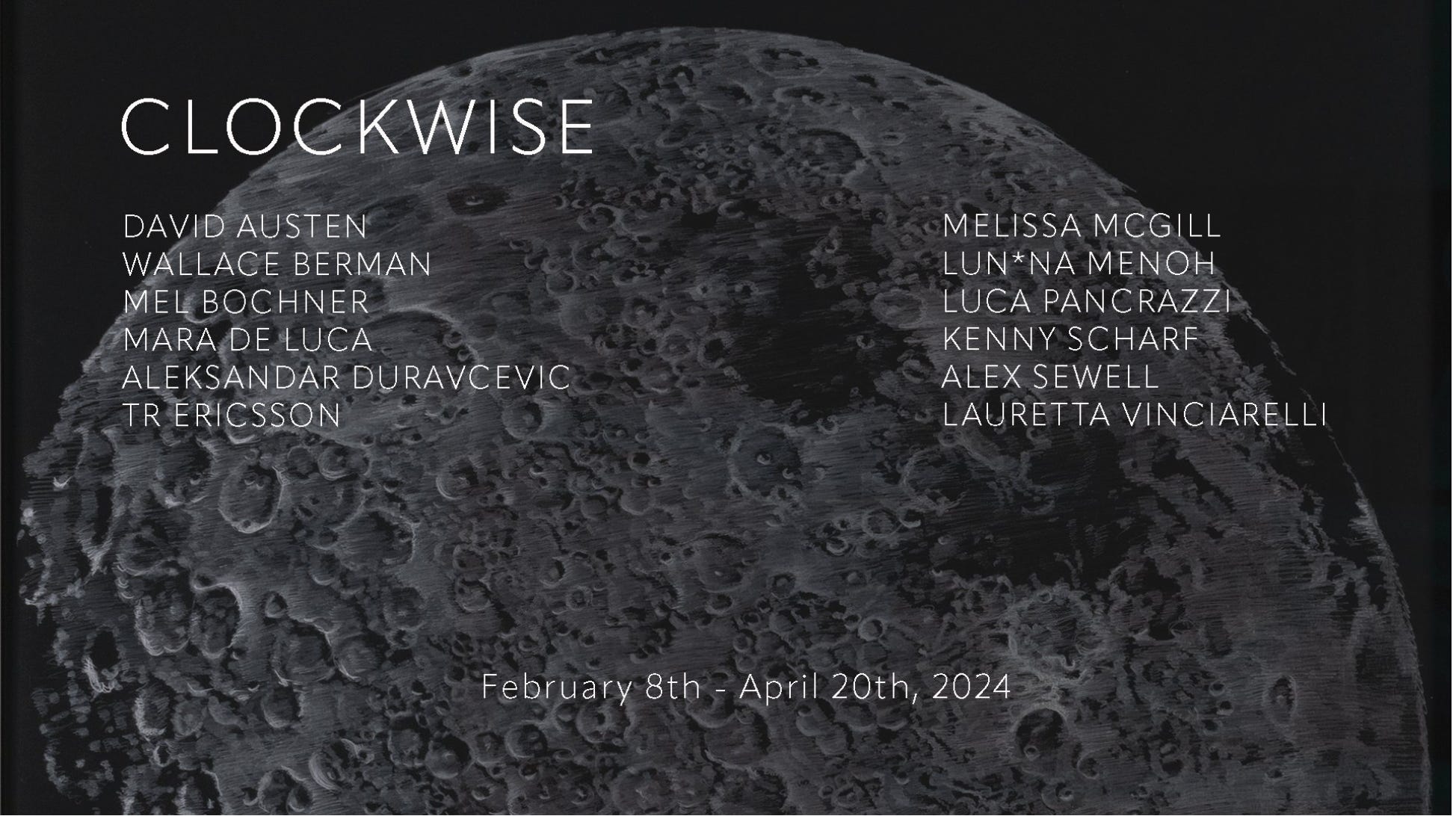
P.S. I am happy to share that the work below is included in a wonderful group exhibition titled Clockwise currently on view at Totah, 183 Stanton Street in NYC, on view until April 20. If you are in the neighborhood, check it out!


Love the new work Melissa. Always impressive. Peter
can’t wait to see them in person!